Iceland not only has the most active volcanoes in all of Europe and countless impressive waterfalls, but also 13 large and several small glaciers that cover a total of about 11% of Iceland's land area. Volcanoes lie beneath many of these glaciers.
How glaciers are formed
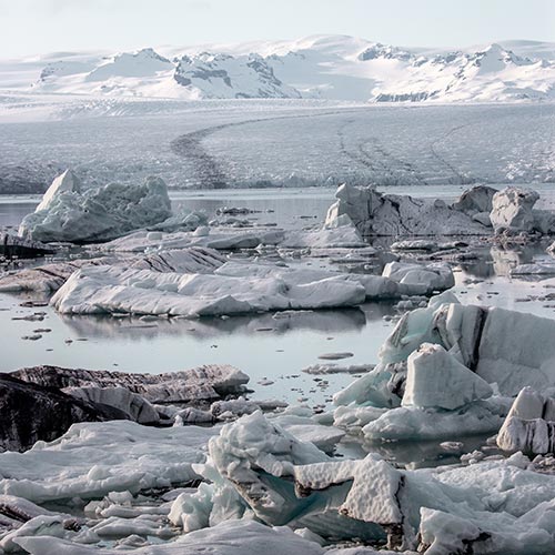
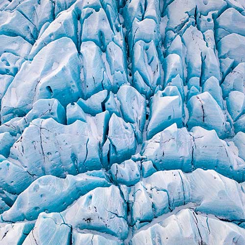
One factor is particularly important for the formation of glaciers: long-term, low temperatures! This is because glaciers consist of metre-high layers of ice that form when fallen snow cannot thaw in summer, freezes and thus forms small crystals. Over the years, more and more layers of snow are piled on top of each other and are compressed by their weight into thick masses of ice. During this process, the air is pressed out of the cavities between the snow and the glacier ice usually takes on a bluish and sometimes even slightly greenish colour due to the low air content.
A distinction is made between different types of glaciers.
Glacier types
- Valley glaciers: The glaciers are often located in valleys and are quite long.
- Foreland glaciers: Glaciers that flow flat out of relatively steep valleys.
- Plateau glaciers: Glaciers that lie on high mountains.
- Slope glaciers: Glaciers "hanging" on steep rock faces
- Karglaciers: Usually wide glaciers that are often located in high mountains. They owe their name to their bowl-like shape. They are remnants of large valley glaciers that have lost their glacier tongue.
- Outlet glaciers: Form at the edge of ice caps or ice sheets when ice must flow through relatively narrow outlets.
- Ice sheets: Cover large parts of (flat) land masses
What glaciers are there in Iceland?
 Vatnajökull
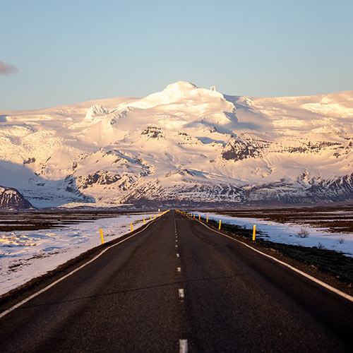
Vatnajökull is not only by far the largest glacier in Iceland, but also in Europe. With its 7,700 km², it covers about 8 % of Iceland's land mass and is on average between 400 and 1,000 metres thick. The highest point is on the Bárðarbunga glacier plateau at an altitude of 2,000 metres. The glacier is located in the southeast of the country and is so large that many of the approximately 40 associated glacier tongues have their own names. These glacier tongues include the following:
- Öræfajökull: largest glacier tongue, in the Southeast National Park.
- Dyngjujökull: one of the largest glacier tongues
- Breiðamerkurjökull: outlet glacier that fills the famous Jökulsarlon lagoon,
- Falljökull: steep glacier tongue, strongly crevassed, The best place for longer hikes
- Svinafellsjökull: one of the most picturesque glaciers in Iceland, location for many films and series
Langjökull
Langjökull, whose name means "long glacier", is the second largest glacier in Iceland. It is located in the west of the highlands and is about 1.5 hours from Reykjavik. This makes it the closest glacier to Iceland's capital. A volcanic system lies hidden under the ice, some of which is 580 metres thick. The glacier is covered with snow all year round, making it the perfect destination for snowmobilers. The glacier is also home to the largest man-made ice cave in the world.
Hofsjökull
Iceland's third largest glacier is located in the central highlands and is therefore quite difficult to access. The almost 1,000 km² of almost circular ice cover can only be visited in summer and even then should only be travelled on after detailed planning and with an experienced guide. A number of mountains stretch upwards along the glacier's edge, including Blágnípa in the west, Arnarfell hið mikla in the south and Miklafell in the east.
 Mýrdalsjökull
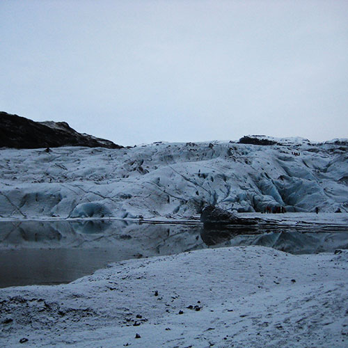
With an area of about 595 km², Myrdalsjökull is the fourth largest glacier on the Nordic island. It is located right next to Eyjafjallajökull. Underneath the glacier is the volcano Katla, which is probably the most active volcano in the northern hemisphere. Nearby is the Thorsmörk valley, considered one of the best hiking areas in all of Iceland. One of the most famous glacier tongues of Myrdalskökull is Sólheimajökull. Solheimajökull is about 10 km long and 2 km wide. It is located about 2 hours' drive from Reykjavik on the southwestern side of Myrdalsjökull and is easily accessible via the ring road. The tongue is rugged with many crevasses and sometimes even has small ice tunnels and caves. Solheimajökull is one of the glaciers most affected by climate change: In the last 10 years it has receded about a kilometre. Other glacier tongues include Kötlujökull. Öldufellsjökull, Sandfellsjökull and Höfðabrekkujökull.
Drangajökull
Drangajökull is the only glacier in the Westfjords and also the only one in Iceland that is lower than 1,000 metres. Nevertheless, it is the fifth largest glacier in the country with an area of about 200 km² and, unlike the other Icelandic glaciers, it has not become smaller. Due to its location southwest of Hornstadir, however, it is also difficult to access, but there are tours to the glacier from Isafjördur.
Eyjafjallajökull
Eyjafjallajökull has been world-famous at least since its eruption in 2010, which paralysed air traffic throughout Europe. It lies directly next to Myrdalsjökull in southwestern Iceland and, at 78 km², is the country's sixth largest glacier. The 100 km wide ice cap is 1615 m high at its highest point. The two glaciers are connected by a popular hiking trail called Fimmrvöðuháls.
Tungafellsjökull
With an area of about 48 km², Tungafellsjökull is the seventh largest glacier in Iceland. It is located on the Sprengisandur highland track, northwest of Vatnajökull. Most of the glacier lies at an altitude of 700-800 metres and is about 70 km long and up to 30 km wide. The glacier is only accessible by road in summer and even then heavy rainfall can make it difficult or even impossible to reach.
Þórisjökull
The glacier volcano is located in the west of the country. Its area is 32 km² and it reaches a height of 1350 metres. The glacier lies to the west of the Langjökull glacier and is separated from it by þórisdalur, where Gretiir, the Saga hero, is said to have stayed.
Eiríksjökull
This 22 km² table mountain with a glacier cap is located in the west of Iceland. From the 1,675 m high glacier peak you have a fantastic view over the surrounding areas. Like many other glaciers, Eiriksjökull has several glacier tongues that extend in all directions. Climbing the glacier is quite challenging, as there is an elevation gain of 1,300 m in 10 km. Normally this is done from the west side.
Þrándarjökull
Thrandarjökull is a 22 km² glacier in south-eastern Iceland, 20 km from Vatnajökull. One of the longest and largest rivers in the east, the Hamarsá, comes from this 1,236 m high glacier.
Tindfjallajökull
Tindfjallajökull is a 19 km² glacier volcano up to 1,462 m high in the south of Iceland adjacent to þórsmörk. It is now one of the smallest glaciers in Iceland, but is still a popular destination for mountaineers and skiers
Torfajökull
The 15 km² glacier partially covers the volcano of the same name north of Myrdalsjökull. Nearby are the warm springs of Landmannalaugar and Hrafntinnusker. The well-known trekking trail Laugavegur leads over the glacier.
 Snaefellsjökull
With an area of 11 km², Snaefellsjökull is one of Iceland's smallest glaciers, but one of the most famous. The glacier is an active volcano that has built up during several eruptions over the last 80,000 years. The glacier became famous through the film "Journey to the Centre of the Earth" by Jules Verne, in which it represents the centre. Snaefellsjökull is part of the national park of the same name, which was established in 2001, and is the only glacier on the Snaefellsnes Peninsula. Driving on the glacier is prohibited unless you have a permit from the park ranger. The glacier's surroundings also have a lot to offer: Hilly lava fields, beautiful black and white sand beaches, unique waterfalls and many animals, such as seals and birds can be found here. Unfortunately, this glacier is also shrinking at an alarming rate. Climbing the glacier is very challenging and takes 5-7 hours.
Developement of the Icelandic glaciers
Historical
Iceland has been completely covered by ice for most of the last 3 million years. During the last ice age 21000 years ago, Iceland was covered by a large ice sheet that probably extended far beyond the coasts. During the climatic optimum 3000-8000 years ago, the average temperature in Iceland was 2 °C higher than in the 20th century, which caused the glaciers to almost completely disappear except for the ice caps on the peaks. Around 500 BC, there was another cold period in Iceland, which allowed the ice caps to spread again. From the beginning of Iceland's settlement (~847 AD) until the 13th century, there was another warm period followed by a small ice age from the end of the 13th century until the end of the 19th century. This ice age led to a renewed expansion of the ice caps.
Current
In 1890, the last Little Ice Age ended and the glaciers retreated once again. Despite the steadily rising temperatures in Iceland, there was a small interruption in the years between 1960 and 1990, when the melting of the glaciers stopped. The area loss of Iceland's glaciers was greatest between 1904 and 1945. Since the year 2000, the glaciers have once again been losing a great deal of area, and this loss is steadily increasing. The ends of Vatnajökull's glaciers have thus shortened by 1-4 kilometres since 1890, and the surface of its southeastern glacier tongues has sunk by 150-270 metres between 1890 and 2010. There are some approaches to protect the glaciers from melting. For example, forests are being planted around the glaciers to absorb the warm air. Statistically, the earth could soon cool down again and cover Iceland with new ice.
Activities around the glacier
There are many exciting activities to do in, on and around the glaciers. However, it is important that no matter how experienced you are, you never enter the glaciers without a licensed local guide, because glaciers can be dangerous!
 Ice caves
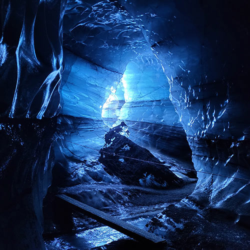
Every year in the winter months, some glaciers create stunning ice caves. These ice cave glaciers are Langjökull, the Kötlujökull (outlet glacier of Mýrdalsjökull), Breiðamerkurjökull and the Falljökull (outlet glacier of Vatnajökull). Probably the best-known ice cave is located at the foot of Breidamerkurjökull. The crystal ice cave is known for its clear turquoise-blue colour, which also looks so spectacular due to the incidence of light through the rather thin ice roof. It can be visited from November to April. Also very popular is the Katla Ice Cave in Kötlujökull, an outlet glacier of Myrdalsjökull. The fairly new cave impresses with its unique formations and even leads to a second ice cave. This cave can be admired all year round.
Glaciers: Solheimajökull, Langjökull (ice tunnel), Breidamerkurjökull, Myrdalsjökull (Kötlujökull), Falljökull
Snowmobile tours
If you prefer to drive a little faster over the glaciers, you can book a tour on a snowmobile. Please note, however, that persons between 6 and 18 years of age and persons without a driving licence are only allowed to ride as passengers.
Glaciers: Langjökull, Vatnajökull, Myrdalsjökull, Eyjafjallajökull
Glacier hikes
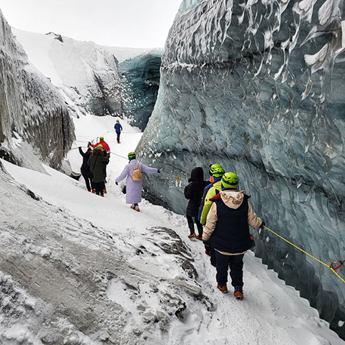
Hiking on Iceland's glaciers is possible all year round. The most popular glaciers for this are on the south coast of Iceland. These include the Solheimajökull glacier tongue on the Myrdalsjökull glacier and Svinafellsjökull. But there are also many tours on the other glaciers.
Glaciers: Sólherimajökull (Myrdalsjökull), Falljökull (Vatnajökull), Svinafellskökull, Eyjafjallajökul, Snaefellsjökull
Ice climbing
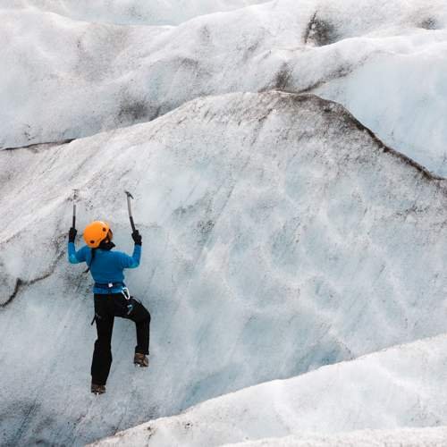
If you still want a bit of a thrill or just like climbing, you should try ice climbing on Iceland's glaciers. The most popular glaciers for ice climbing are Svinafellsjökull and Solheimajökull. Although ice climbing is also possible all year round, in winter you have the additional special opportunity to climb on frozen waterfalls.
Glaciers: Solheimajökull (Myrdalsjökull), Svinafellsjökull, Vatnajökull, Skaftafell
A wide range of excursions to the glaciers can be booked directly with us - just contact us! For more ideas, take a look at our other excursions. Find inspiration for your next round trip to Iceland here.
